A free direction and GPS tracking app
Google Maps is a free travel and navigation app to find your way home, learn details about locations or stores, and calculate distances before traveling. It’s beneficial if you want to discover eateries, shopping malls, gas stations, and more in your area. This app is excellent if you need directions to a specific place.
Top Recommended Alternative
Google Maps has become an indispensable tool for travelers, daily commuters, and explorers alike. It’s a well-rounded navigation and location discovery app, packed with features that go beyond just getting users from point A to point B. It has an intuitive interface, real-time data, and a comprehensive suite of tools.
Navigate and discover the world
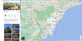
Google Maps is a free program built for navigation and obtaining information. The Google servers and people who use the application provide info so that the application can function properly. It’s easy to jump in and search for your favorite places anywhere in the world. You can also take a quick peek and observe different cities with satellite and road-based images. This app has direct competition from Waze. You can use this application to navigate the world with driving directions. While many GPS apps are available, these two are the most dependable and consistent.
These have a similar approach, although Waze has a more simplistic style. It’s worth noting that they’re both Google software. However, this app does more than just point you in the right direction. It has a wide variety of extra features that make it a must-have. These include reviews, personalized location suggestions, route options, bus stop information, group planning add-ons, and more. You’ll sometimes find yourself using these bells and whistles more than Maps’ main purpose.
Provides the best route for you
It’s easy to follow the app’s directions, especially when you get to pick your favorite route. It has a few options you can select from with different priorities. If you’re low on gas, it can single out the best option for saving gas. If you’re running a bit late, you can ask for the fastest route available or minimize the number of stop signs and traffic lights on the way. If you’re on foot or need to take a bus, you can alternate between them to more accurately calculate your estimated time of arrival.
When you swap between these, the interface changes accordingly. If you’re walking, it’ll buzz twice when you need to turn and once after every block; there’s no need to hold your phone out as you roam the streets. The Maps’ public transport feature is also fantastic. You can see the times for each stop. If you input a destination that requires more than one bus, it’ll tell you how many you need to take and where each bus stop is. If any vehicle is running late, a nifty notification will pop up.
Offers a smooth interface
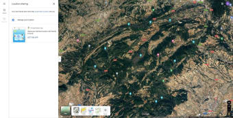
It’s easy to move around Maps’ different menu systems and options. You can access tons of settings and tweaks with a slide of your finger to the right. Otherwise, the majority of the screen is a map of the area you’re interested in. You can swap between satellite and roads for a different visual feel, depending on personal preference. The app responds to the day and night cycle. It switches to a dark theme or white to reflect the local time.
While you can’t customize your icon on the map, you can modify different areas near you. For example, if you love a specific bakery, you can mark it with a tag of varied colors. Google Earth has a very similar approach to the general interface. In both apps, you can drop down to surface level and explore different areas in 360 degrees. Maps’ Street view has images that are high quality and make it easy to find a specific store you’re trying to find. Google Earth lacks navigation options, though.
Has several AI-enhanced features
With its updated properties, the app has introduced several AI-enhanced features designed to improve navigation, personalization, and sustainable travel options. One of the most innovative updates is the AI-powered Lens integration, which enables a new “Search with Live View” feature. This tool combines augmented reality with map data, allowing users to explore local details by pointing their cameras at their surroundings. For instance, it can help you discover nearby restaurants, ATMs, and transit stations, offering detailed overlays on-screen.
Additionally, it has made eco-friendly routing even more accessible by automatically suggesting routes with a lower carbon footprint, considering factors like road incline and traffic patterns. With this feature, it assists with fuel efficiency and aligns with the company’s broader sustainability goals. Users can compare potential carbon dioxide emissions for different routes or opt for the fastest route based on their needs.
On the accessibility front, the platform has improved features for visually impaired users, offering voice guidance with enhanced accuracy and providing details on accessibility routes. These upgrades collectively aim to make the app a versatile tool that adapts to user needs in real needs in real-time and offers greener, more accessible navigation options worldwide. On the other hand, it also has expanded Street View imagery to 80 countries, including new additions like Iceland, New Zealand, Brazil, and Mexico. This expansion allows users to virtually explore a broader range of destinations worldwide.
The app has also integrated with SpotHero, enabling users to find and reserve parking spots directly through the app. This addition aims to alleviate the stress of searching for parking, especially in densely populated areas. These updates collectively enhance the functionality and user experience of the app, offering improved navigation, safety, and convenience. However, using this app, especially with real-time navigation and GPS, can consume significant battery power.
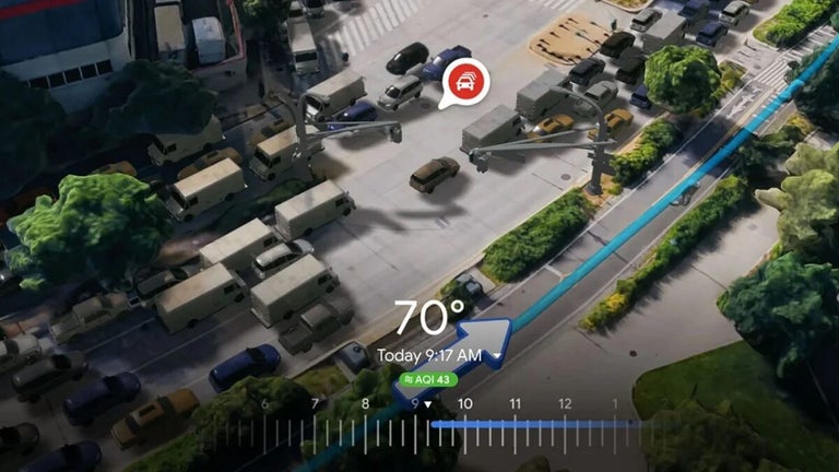
Gemini AI and real-time 3D upgrades
Google Maps recently rolled out a major update that fundamentally changes how we get around, mostly thanks to a deeper integration of artificial intelligence. The standout feature here is Ask Maps, which is powered by Google Gemini. Instead of typing in a rigid address or a basic keyword, you can now type or speak to the app like you are talking to a local friend. You can ask for highly specific recommendations, and the app will instantly scan millions of real-world user reviews to build a custom itinerary for you on the spot.
To make driving much less stressful, Google also introduced Immersive Navigation. This feature transforms the classic flat map into a clear 3D view of your surroundings while you are behind the wheel. It shows complex lane changes, overpasses, and crosswalks exactly as they appear in reality, and it even makes buildings semi-transparent as you approach a turn, so your view is never blocked. Combined with smarter, predictive traffic alerts that spot delays before you hit them, the app is much less like a passive digital map and more like an active co-pilot.
A must-have app for travel
Overall, Google Maps has everything you need to move around the city or go on a long road trip. It’s easy to use, fast, has a clean interface, and works like a charm. However, watch out for battery usage because this application drains power quite quickly. With this app in your pocket, you can go anywhere. In the latest patch, you can share your location. You can set this to last 24 hours or until you turn it off.
Google Maps supports movement around host cities during the FIFA World Cup 2026.
• Use google maps to reach stadium and fan zone locations.
• Covers routes between host cities across three countries.
• Driving and transit directions for match days.